The Sitka Hurricane of 1880
 |
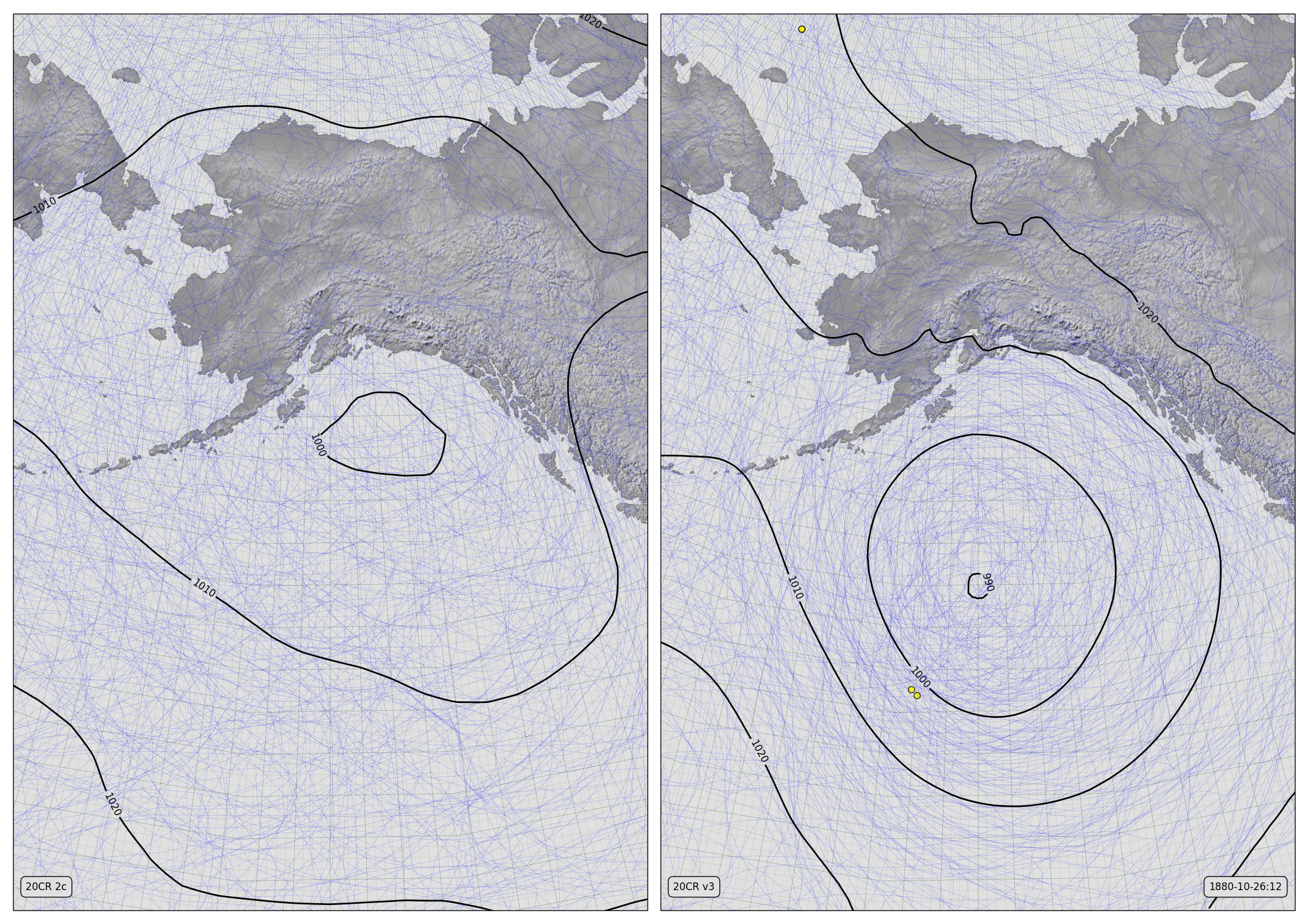
| Two reconstructions of the ‘Sitka Hurricane’. Pressure contours before (left) and after (right) adding oldWeather-Arctic observations from USC&GS Yukon. (Details). |
Sitka is in the Alaska panhandle, at 57 degrees North. So the storm that hit them on October 26th, 1880 can’t possibly have been an actual hurricane. But it was a very severe extratropical cyclone – probably stronger than any storm that has hit the Sitka region since.
Worst-on-record storms for any region are worth studying – they set a benchmark for predictions of future extreme weather, and they are a great target for attribution – can we find out just why they were so bad? Some of our colleagues, led from the University of Bern, looked at this storm in the Twentieth Century Reanalysis. Almost immediately, they hit a snag:
Because the next assimilated pressure measurements are located more than 1000 km south of Sitka, the storm cannot be found in the 20CR2c ensemble mean
That is, because there are no pressure observations from the north-east Pacific in our databases for late 1880, the reanalysis uncertainty is so large we can’t say anything much about it.
But that was pre-oldWeather Arctic – since then we’ve put many new observations from oldweather into a major database update, and the Twentieth Century Reanalysis (20CR) team have been working night and day building a new version of their reanalysis. The resulting improvement is large – the image above shows a before-and-after reconstruction: The key is those black concentric circles – a characteristic marker of a storm in a weather map, and of course the yellow dots – those mark our new observations. The hero here is USC&GS Yukon, providing those vital observations in the north Pacific. (You can just about see the the Jeannette up there in the Arctic Ocean also, but she’s too far away to have much effect on this storm).
But Wait, There’s More!
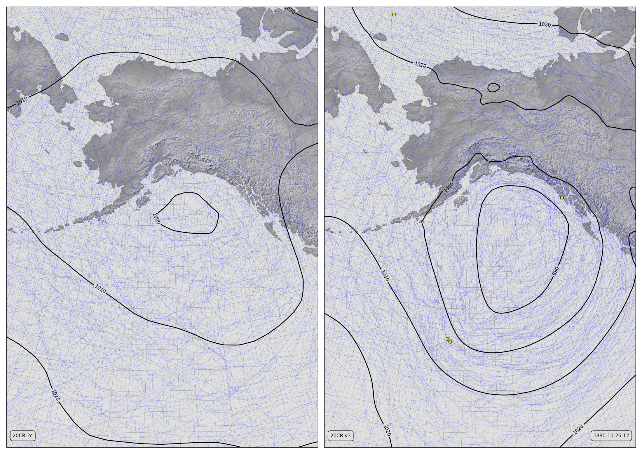
When we sent out our last batch of new observations to the climate datasets we had not completed USS Jamestown, but now we have, and the Jamestown was moored in the harbour at Sitka at the time of the storm. So we shipped those data over to the 20CR team, and they quality controlled them and managed to add them to their system just in time to include them in the final reconstruction for their new reanalysis. So we have another new reconstruction, with our Jamestown observations in too:
 |
| Two reconstructions of the ‘Sitka Hurricane’. Pressure contours from 20CR2c (left) and 20CRv3 (right) adding oldWeather-Arctic observations from USC&GS Yukon and USS Jamestown. (Details). |
Adding the Jamestown strengthens and improves the storm reconstruction still further (particularly apparent in the video diagnostic).
So thanks to everyone who has worked on the Yukon, the Jamestown, and 20CRv3 – between us, we’ve created a hurricane: An iconic storm which was missing in the last reconstruction is present in the new one. The uncertainty in the reconstruction is still large, but future researchers now have something concrete to work on.
